Central envoy’s report admits Tolleaband area low-lying & flood prone; maintains flooding is routine phenomenon; stresses on comprehensive drainage plan

MARGAO
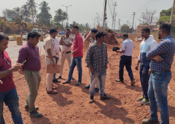
In his report on the flood situation at the Tolleaband stretch of the river, the expert R K Pandey has admitted that the Tolleaband water catchment area is low-lying and flood prone, but maintained that flooding is a routine phenomenon during monsoons and cannot be prevented entirely, till a comprehensive drainage plan addressing the outfall issue is sorted out.
In this context, the expert has pointed out that the discharge capacity of River Sal also needs to be taken into consideration, which he stated appears low, while suggesting measures for increasing the discharge capacity of River Sal may be taken including de-silting/ dredging.
The expert has also touched on the existing drainage on the Margao-Varca road for the drainage of flood water from Tolleaband to the Sal river. He observed that while the bypass is having 10 Nos. of balancing culverts in 650 m length (total area 157 sqm), the 750m Varca road is having only two Nos. culverts (total area 36 sqm) for discharging water into the Sal river, which is insufficient for quick drainage. There is need to provide additional discharge area from Varca road to Sal river by way of increasing the culvert size or its numbers, Pandey suggested.
During his inspection, Pandey touched upon various aspects of flooding in and around the Tolleaband water catchment area. A report.
Flood Situation
During inspection, it was observed that the entire low-lying area on both sides of the Margao bypass was indeed inundated. The vents of the balancing culverts on bypass were allowing the water to pass through. Water level on either side of the bypass is same which reinforces that the bypass on embankment is not causing obstruction to the flow of flood water. It is the absence of outfall which is leading to this situation.
It is pertinent to note that 1.20 km stretch which is proposed on stilts, and where work has been completed up to pier cap level is also flooded with same water level on either side. This again leads to same conclusion as stated above.
Habitation in flood plain
Another important aspect which deserves consideration is, on the right hand side of the bypass, there is a small linear habitation in around 220 m length, at a distance of around 100 m within the flood area.
Even if bypass is constructed on stilts in the portion demanded, this habitation is going to obstruct the natural course of water from catchment towards the bypass and onwards to Sal river. As such, this will make about 220 m length on stilt ineffective.
OBSERVATIONS
General hydrology and flow pattern
Alignment of the bypass passes through the flood plains. Sal river acts as outlet to the entire catchment area through which alignment of bypass traverses. However, during high tide, there is backwater (opposite flow) which is reported to extend up to 31.900 km. The catchment is a low-lying area. Because of the topography of the area, inundation during monsoon is a routine affair.
Sal river runs along the bypass: There are two connecting roads i.e. Khareband road and Varca road which joins with the bypass at two ends of 650 m disputed length. These roads form a triangular area. Sal river is running parallel to Varca road but on the other side of the bypass. Thus, water from the triangle area has to cross Varca road before it discharges into sea through Sal river. Photograph below explains. The 750m Varca road is having RCC wall towards the flood plain with only two culverts, having size of 6mx3m (one in the middle and other at end) which are discharging water from flood plain to Sal river. This water from the triangular area is going into the Sal river through the two culverts (6mx3m) on Varca road. These two culverts are insufficient to cater for the quick discharge of the whole catchment. Further, the downstream of these culverts are found obstructed due to debris and weeding. Against these two culverts (area 36 sqm) in Varca road there is proposal for construction of 10 Nos. of culverts (area 157 sqm), having more area than the area available at Varca road. Work of construction of culverts has already been completed. Thus, construction of bypass on embankment is not the cause of obstruction to flow leading to flooding of the area.
CONCLUSION
Based on the examination of available records and site inspection following conclusion is made:
(a) The area is low-lying and flood prone. Flooding is a routine phenomenon during monsoons and cannot be prevented entirely, till comprehensive drainage plan addressing the outfall issue is sorted out.
(b) Construction of embankment in any flood area may affect the area in the following manner;
i. Obstruct the natural flow leading to aggravation of flooding. This is not the case in this project for the reasons recorded in para 4 above.
ii. Embankment in flood area may lead to reduction of the storage capacity of the flood area thereby increase in water spread and/or increase in the level of flood. This depends upon the volume of embankment compared to the catchment area. In this regard, report of the expert group has been relied, which states, “the highway on embankment will occupy 2.18 per cent of the flood plains and result in afflux of three cm which will not cause any significant rise in the flood level due to filling.”
In view of the above, it is felt that apprehension of flooding due to embankment is not well founded.
(c) Even if, 650 m portion is constructed on stilt, because of habitation parallel to proposed bypass in a length of about 220 m will make stilt portion in corresponding length inoperative and investment will be infructuous.
(d) In areas where no well define channel exists, culverts are preferred. While the bypass is having 10 Nos. of balancing culverts in 650 m length (total area 157 sqm), the 750m Varca road is having only 2 Nos. culverts (total area 36 sqm) for discharging water into the Sal river, which is insufficient for quick drainage. There is need to provide additional discharge area from Varca road to Sal river by way of increasing the culvert size or its numbers.
(e) Discharge capacity of Sal river also need to be taken in to consideration, which appears to low. Measures for increasing the discharge capacity of Sal river may be taken including de-silting / dredging
(f) Work has been taken up and any modification at this stage will lead to work done as infructuous and delay the whole project.