MAPUSA
Despite an overall 11 per cent deficit in all-India rainfall for June, Goa has managed to receive near-normal rainfall distribution. However, the State's changing precipitation patterns have become increasingly evident, causing concern among both residents and scientists.
The most striking observation has been the erratic nature of rainfall. Sudden and intense downpours are now common in many areas, while other regions experience prolonged dry spells.
Additionally, unseasonably warm weather continues to plague the State, even though it is well past the pre-monsoon phase. This anomaly has left citizens uneasy, as they grapple with the effects of these climatic changes.
“There is no doubt that there is a noticeable change in rainfall pattern. And it is the effect of marine heat waves,” explained Dr A K Saran, Senior Principal Scientist at the National Institute of Oceanography (NIO).
Dr Saran attributes these changes to the increasing temperature contrast between land and ocean, driven by global warming and climate change.
“Compared to a decade or 20 years ago, the sea surface temperature of the Arabian Sea and the Bay of Bengal has increased significantly. The warming of the Arabian Sea has been more rapid than that of the Bay of Bengal over the last decade or more,” he noted. “Normally, oceanic sea temperatures range from 28 to 29 degrees Celsius. However, over the past two decades, these temperatures have risen substantially, now ranging from 28 to 30 degrees.”
According to Dr Saran, these marine and atmospheric changes have fundamentally altered the monsoon pattern.
“The precipitation is now characterised by sudden, intense bursts rather than a steady rainfall over a larger area and longer duration. These abrupt downpours are followed by periods of significantly reduced rainfall, which does not cover a vast area,” he explained.
Furthermore, the once consistent and robust contrast between land and ocean temperatures during the summer and monsoon seasons has diminished.
“Pre-monsoon showers in Goa and the Western Ghats are now very sporadic and marked by heavy precipitation,” Dr Saran added.
He attributes these changes to phenomena such as the Indian Ocean Dipole effect and the El Niño and La Niña effects.
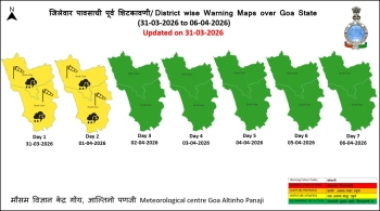
Data from the Indian Meteorological Department (IMD) supports these observations.
From June 1 to July 4, Goa received 1,057 mm of rainfall, just shy of the normal 1,063 mm, resulting in a minor deficit of 0.6 percent.
Despite this, seven regions – Ponda, Sanquelim, Valpoi, Canacona, Margao, Quepem, and Sanguem – have recorded over 1,000 mm of rainfall within the same period.
Dr Ramesh Kumar, a scientist with NIO and former meteorologist with the IMD, highlighted that this year’s rainfall has been significantly better compared to the same period last year.
“Overall, June was a good monsoon month for Goa compared to last year. The La Nina effect is expected to bring abundant rainfall to the Indian subcontinent, including Goa, in the next two months,” Dr Kumar predicted.
As Goa continues to adapt to these changing climatic conditions, the authorities remain vigilant, closely monitoring weather patterns and preparing for the potential impacts of these significant shifts in their environment.