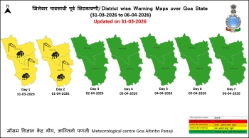
Most parts of State experienced sketchy rains on Sunday
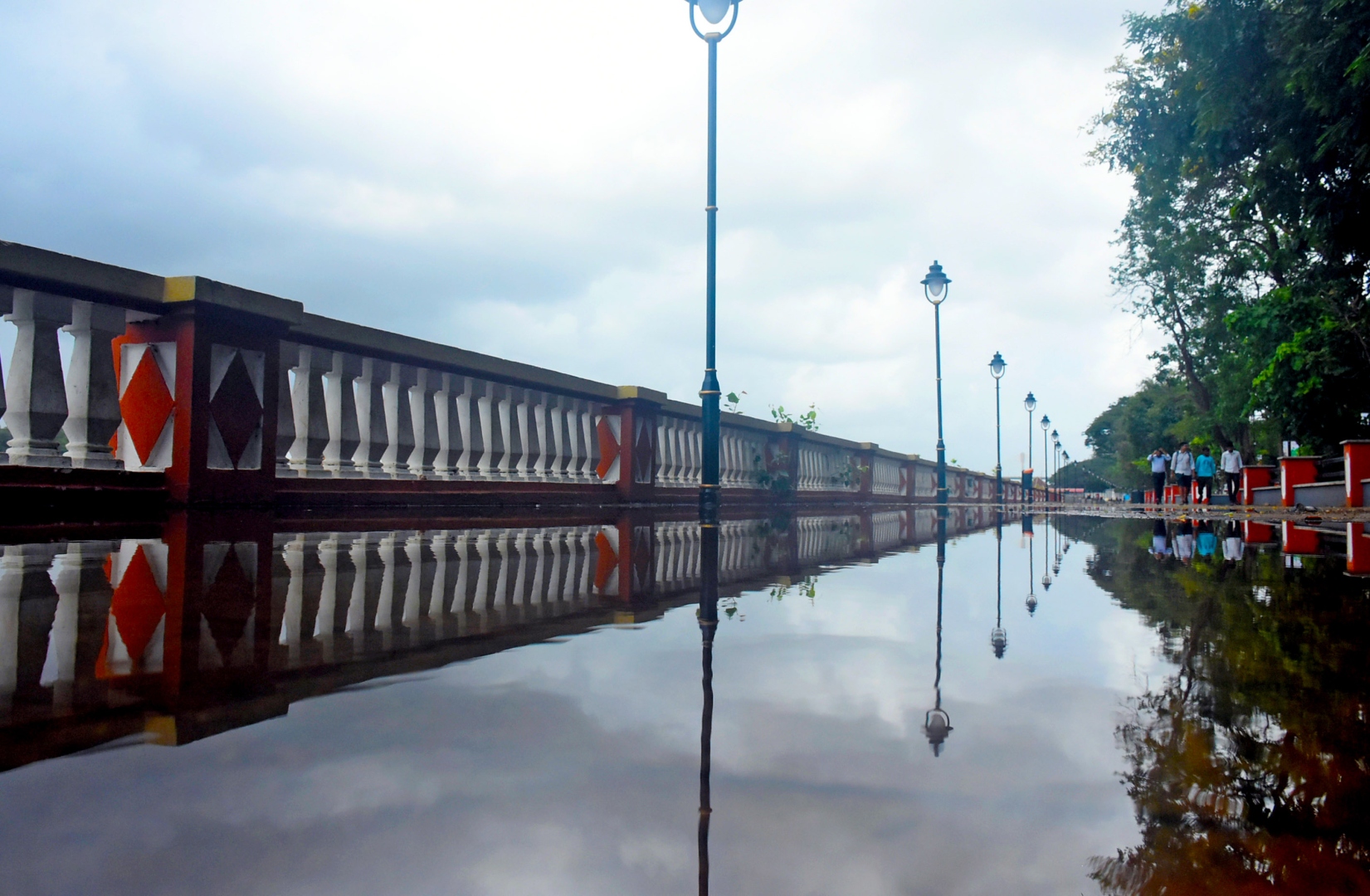
City promenade near ferry jetty water-logged after a spell of rain as the monsoon hits the State.
MAPUSA
After a six-day delay, the Southwest monsoon arrived in Goa, but it made a quiet entry in the State on Sunday.
It also advanced to more parts of Konkan, central Arabian Sea, Karnataka and most parts of Tamil Nadu.
The normal date for onset of monsoon over Goa is June 5.
Announcing the onset of monsoon over Goa, the India Meteorological Department (IMD) said monsoon had reached neighbouring Karwar on Saturday a day after reaching Kerala.
“The Southwest monsoon has further advanced into Goa, some more parts of central Arabian Sea, Karnataka, Konkan, most parts of Tamil Nadu and Puducherry, some parts of Andhra Pradesh, entire southwest and some more parts westcentral Bay of Bengal on June 11,” the IMD bulletin said.
However, most parts of Goa experienced sketchy rains on Sunday even as the weather during the day was hot and humid.
In fact, the State received a good amount of rainfall a day earlier, on Saturday, and the amount of rain recorded at various centres in the last 24 hours tells a story.
Panaji recorded 49.2 mm of rain while Margao received 22.1 mm and Mormugao 51.7 mm.
Similarly, Mapusa (32 mm), Pernem (49.4 mm), Ponda (18 mm), Canacona (18.2 mm), Dambolim (48.8 mm) and Quepem (20 mm) are the other centres that recorded rainfall from 8.30 am on June 10 to 8.30 am on June 11.
Light to moderate rain is expected in Goa for the next four days with thunder showers predicted on Monday.
Meanwhile, the IMD has sounded a warning along South Maharashtra-Goa coasts and fishermen have been advised not to venture into the sea for next three days.
The INCOIS has also warned of high waves in the range of 3.5 to 3.8 metres along the coast of Goa between Vengurla to Vasco.
In the meanwhile, the very severe cyclonic storm “Biparjoy” over eastcentral Arabian Sea moved north- northeastwards with a speed of 9 kmph during past six hours, intensified into an extremely severe cyclonic storm and lay centered about 580 km west-southwest of Mumbai, 480 km south-southwest of Porbandar, 530 km southsouthwest of Devbhumi Dwarka, 610 km south-southwest of Naliya and 780 km south of Karachi (Pakistan).
It is very likely to move nearly northward till June 14 morning, then move north- northeastwards and cross Saurashtra & Kutch and adjoining Pakistan coasts between Mandvi (Gujarat) and Karachi (Pakistan) around noon of June 15 as a very severe cyclonic storm with maximum sustained wind speed of 125-135 kmph gusting to 150 kmph.