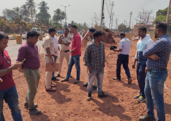
Move to identify fishermen houses along coastal belt
PANAJI
The Goa Coastal Zone Management Authority (GCZMA) has decided to undertake the digital global positioning system (DGPS) survey for identification of fishermen houses across 257 fishing wards spread in seven coastal talukas.
The DGPS survey, to be completed within 120 days of issuing work order, will cover the coastal talukas of Canacona, Salcete, Mormugao, Ponda, Tiswadi, Bardez and Pernem. The survey will include identification of fisherman committee and fisherman houses.
The GCZMA will appoint a separate contractor for each of the taluka for undertaking the exercise. The Authority has already invited tenders from the interested parties having requisite experience in carrying out DGPS survey.
According to the tender document, Bardez taluka has got the maximum 83 fishing wards, followed by 47 in Canacona, 44 in Salcete, 34 in Mormugao, 22 in Tiswadi, 15 in Pernem and 12 in Ponda. The tender cost for each of the taluka varies.
The Authority has identified total 3,855 GPS points in 257 fishing wards. The survey will be done as per the directions of Fisher Planning Committee (FPL), representative of department of settlements and land records (DSLR) and local fisherman society.
The GCZMA has made it clear that the final survey report has to be accepted by FPL, DSLR and local fisherman society before submission to the government.
Pending finalisation, Fisherman Community Plan remains a mere document
Almost a year after Goa’s Coastal Zone Management Plan (CZMP) 2011 was notified, the crucial sub plan- Fisherman Community Plan is yet to be approved by the State government. The fresh exercise has been undertaken in view of preparation of CZMP 2019.
The Fisherman Community Plan, drafted by the experts from GCZMA, speaks about regularisation of dwelling units constructed or permissible under CRZ 1991 notification on a case-to-case basis. It also permits construction and reconstruction of dwelling units of traditional coastal communities between 100-200 meters of HTL.
The plan that has identified 250 fishing wards falling within or adjacent with CRZ areas, speaks about permitting foreshore facilities for fishing and allied activities along the protected zones.